SpaceEye-T
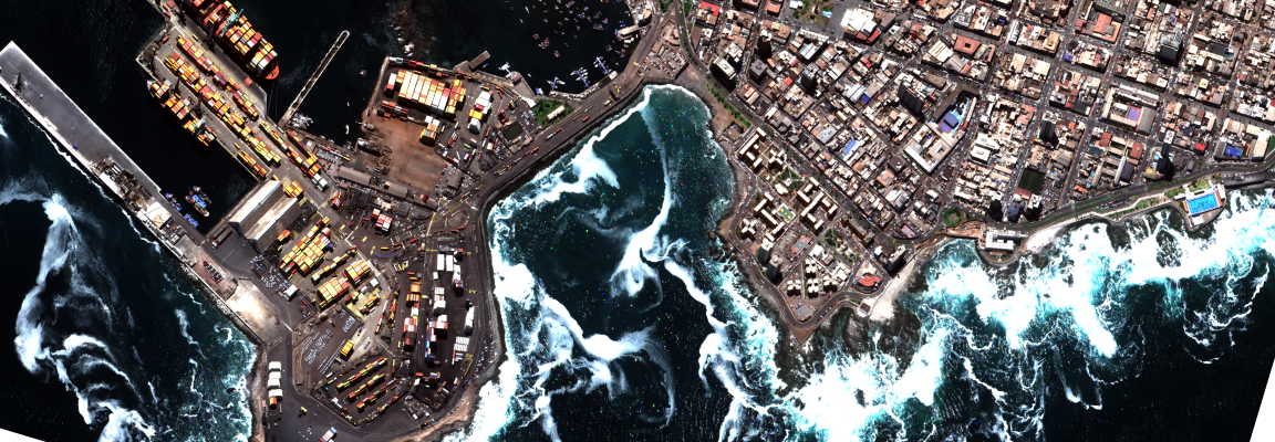
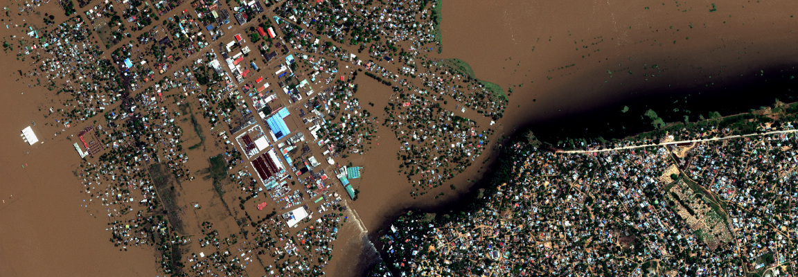
SpaceEye-T is a very-high-resolution optical satellite delivering 25-cm panchromatic and 1-m multispectral imagery—among the finest resolutions commercially available—enabling the identification of micro-targets such as vehicles and road markings. It features a 12 km swath width, a daily collection capacity of 300,000 km², and ITAR-free compliance for low operational friction. Users can choose between Sat-aaS (exclusive satellite leasing for dedicated tasking) and T-aaS (API-based access to fresh and archived imagery) to suit their mission needs.
Order Type
Archive
Historical imagery data
- Minimum Order
- 25 km²
- Acquisition Time
- Archived data acquired since 2025
- Price (Per km²)
- $15$10
Additional Benefit: Free SR
Prices are based on platform purchases and may vary depending on selected options or license terms.
Buy Now
Technical Specifications
| Item | Details |
|---|---|
Sensor Type | Optical |
Spatial Resolution | 0.25 m |
Off-nadir Angle | Roll ±45°, Pitch ±30° |
Spectral Bands | PAN, VNIR |
Geographic Coverage | Global |
Data Release Date | 2025.03 |
CRS | SEN: Geographic WGS84 / PRJ·ORT: WGS84 UTM(EPSG) |
Min AOI Size | Archive 25 km² |
Revisit rate | 1 day |
Processing Levels | L3 / L2A |
Max AOI Size | 10 km x 10 km |
Swath Width | 12 km |
Minimum Solar Elevation Angle | 0~90° |
Solar Local Time | 10:30 MLTAN |
System Acquisition Mode | Standard (SSI), Stereo (STI) |
Delivery Format | GeoTIFF or JPEG2000(DIMAP 2.0) |
Bit Depth per Pixel | 12-bit |
Positional Accuracy | ≤10 m CE90 |
Description | Key Advantages of the Satellite: - 25 cm-class Very Very High Resolution (VVHR) imagery Main Application Areas: Urban change detection, mapping (DEM/DSM), precision agriculture monitoring, maritime disaster response, defense and military intelligence gathering, and other related applications |
Copyright Policy
| Item | Data License Agreement |
|---|---|
| CC BY 4.0 | View Data License Agreement |